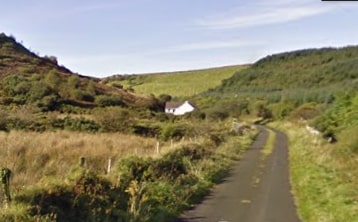
Bonniconlonn is located in North East Mayo approximately 10 km from Ballina. A network of recreational trails have been developed in this area. The complete package of trails is marketed as the Bunnyconnellan Trails.
- Location: Bonniconlonn Village, Co Mayo
- Trailhead / Start Point: Football Pitch, Bunnyconnellan Village
- Terrain: Country Lanes & Stony Paths
- Direction: Red markers
- Distance: 19.6 km
- Estimated Time: 5 hours
- GPS Location: 54.1084, -9.0254
- Grade: Hard.
- Minimum Gear: Hiking boots, waterproofs, mobile phone, snacks & fluids
- Services: Crossmolina, Ballina